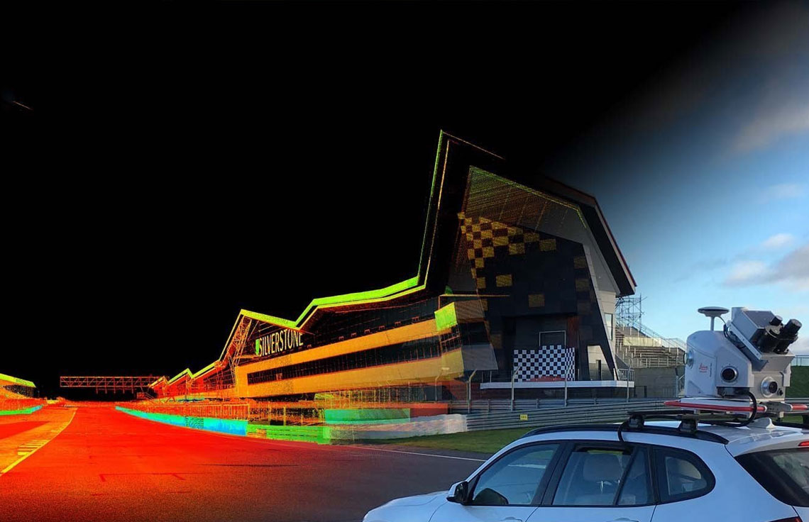
Mobile Mapping
Beyond the traditional Corridor Asset Mapping
Mobile Mapping is the process of collecting geospatial data from mobile vehicles, typically fitted with a range of GNSS, photographic, radar, laser, LiDAR or any number of remote sensing systems. In recent years, 3D Mobile Mapping has become one of the most important geospatial technologies available, and it is set to change the way environments are measured, visualised, analysed and catalogued.
Acedata Technologies’s experienced engineers review the dataset to check the required coverage and quality of the point cloud. We use latest software to process the dataset and deliver the final output in the preferred format.
OFFERINGS
Let’s get started
Contact us today to discuss the most advanced and efficient solutions for your next project.